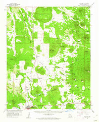
1960 Map of Williams
USGS Topo · Published 1961About this map
The high plateaus of Kaibab National Forest dominate this 1960 survey, centered on the historic gateway town of Williams. The Atchison Topeka and Santa Fe railroad corridor cuts through the landscape, providing a primary transport link for the region alongside the Williams Airport. Distinctive landmarks like Sitgreaves Mtn and Howard Mesa rise above the forest floor, while the presence of the Grand Canyon Trading Post near the Williams City Boundary signals the area's role in northern Arizona tourism and commerce.
Find a feature on this map
75 named features on this map. Tap any name to fly to it.
Don’t see what you’re looking for? This feature index may not catch every label — zoom into the map to look around manually.
Map Details
Editions of this 1960 Williams Map
2 editions found
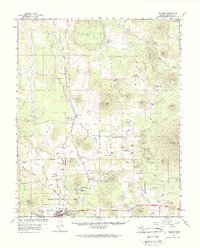
Other maps of this area

1886 · San Francisco Mtns
USGS Topo · 1:250,000

1886 · Chino
USGS Topo · 1:250,000

1891 · San Francisco Mtns
USGS Topo · 1:250,000

1891 · Chino
USGS Topo · 1:250,000

1894 · San Francisco Mtns
USGS Topo · 1:250,000

1899 · San Francisco Mtns
USGS Topo · 1:250,000

1908 · Flagstaff
USGS Topo · 1:125,000

1912 · Flagstaff
USGS Topo · 1:125,000

1922 · Williams
USGS Topo · 1:125,000

1947 · Flagstaff
USGS Topo · 1:250,000