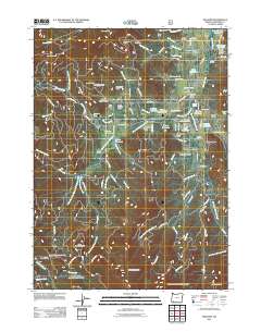
2011 Map of Williams
USGS Topo · Published 2011About this map
Williams serves as the central hub of this Southern Oregon landscape, where the Williams Post Office and Williams Forest Service Facility anchor the local community. The terrain is defined by a dense network of gulches and watercourses, including Williams Creek, North Fork Munger Creek, and East Fork Williams Creek. Evidence of the region’s extractive history is visible in the scattered workings of the Red Rose Mine, Watts Mine, and the Jones Marble Quarry near Bristol Quarry.
Find a feature on this map
107 named features on this map. Tap any name to fly to it.
Don’t see what you’re looking for? This feature index may not catch every label — zoom into the map to look around manually.
Map Details
Editions of this 2011 Williams Map
This is the sole edition of this map. No revisions or reprints were ever made.
Other maps of this area

1908 · Grants Pass
USGS Topo · 1:125,000

1954 · Oregon Caves
USGS Topo · 1:62,500

1954 · Gold Hill
USGS Topo · 1:62,500

1954 · Grants Pass
USGS Topo · 1:62,500

1954 · Ruch
USGS Topo · 1:62,500

1955 · Medford
USGS Topo · 1:250,000

1957 · Medford
USGS Topo · 1:250,000

1958 · Medford
USGS Topo · 1:250,000
1983 · Tallowbox Mtn
USGS Topo · 1:24,000
1983 · Carberry Creek
USGS Topo · 1:24,000