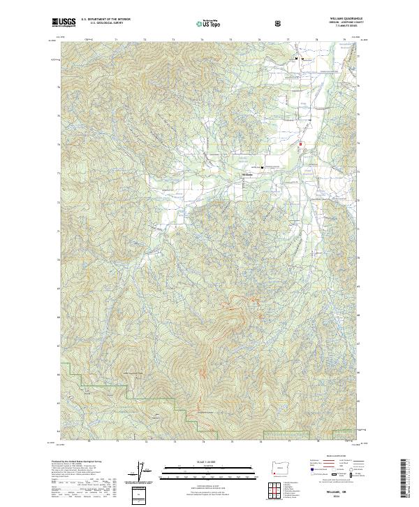
2024 Map of Williams
USGS Topo · Published 2024About this map
Williams serves as the central hub of this Josephine County landscape, situated where the West Fork Williams Creek and East Fork Williams Creek begin to converge. The settlement is surrounded by a network of small family-named reservoirs, including Hartley Reservoir, Whittier Reservoir, and Remey Reservoir, illustrating the area's historical reliance on localized water management for agriculture and homesteading. Further south, the terrain rises sharply toward the Siskiyou National Forest, culminating at Grayback Mountain and the high meadows of the Grayback Glades.
Find a feature on this map
99 named features on this map. Tap any name to fly to it.
Don’t see what you’re looking for? This feature index may not catch every label — zoom into the map to look around manually.
Map Details
Editions of this 2024 Williams Map
This is the sole edition of this map. No revisions or reprints were ever made.
Other maps of this area

1908 · Grants Pass
USGS Topo · 1:125,000

1954 · Oregon Caves
USGS Topo · 1:62,500

1954 · Gold Hill
USGS Topo · 1:62,500

1954 · Grants Pass
USGS Topo · 1:62,500

1954 · Ruch
USGS Topo · 1:62,500

1955 · Medford
USGS Topo · 1:250,000

1957 · Medford
USGS Topo · 1:250,000

1958 · Medford
USGS Topo · 1:250,000
1983 · Tallowbox Mtn
USGS Topo · 1:24,000
1983 · Carberry Creek
USGS Topo · 1:24,000