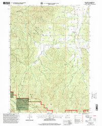
1996 Map of Williams
USGS Topo · Published 1999About this map
Williams sits at the heart of this valley landscape, where the agricultural flats meet the rising slopes of the Siskiyou National Forest and Rogue River National Forest. The map documents a landscape defined by natural resource extraction and rugged terrain, featuring the Red Rose Mine and the Jones Marble Quarry in the northern hills. The drainage network is complex, with Williams Creek collecting various tributaries such as Munger Creek and Goodwin Creek as they flow from the high ridges.
Find a feature on this map
44 named features on this map. Tap any name to fly to it.
Don’t see what you’re looking for? This feature index may not catch every label — zoom into the map to look around manually.
Map Details
Editions of this 1996 Williams Map
This is the sole edition of this map. No revisions or reprints were ever made.
Other maps of this area

1908 · Grants Pass
USGS Topo · 1:125,000

1954 · Oregon Caves
USGS Topo · 1:62,500

1954 · Gold Hill
USGS Topo · 1:62,500

1954 · Grants Pass
USGS Topo · 1:62,500

1954 · Ruch
USGS Topo · 1:62,500

1955 · Medford
USGS Topo · 1:250,000

1957 · Medford
USGS Topo · 1:250,000

1958 · Medford
USGS Topo · 1:250,000
1983 · Tallowbox Mtn
USGS Topo · 1:24,000
1983 · Carberry Creek
USGS Topo · 1:24,000