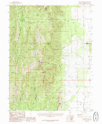
1985 Map of Williams Peak
USGS Topo · Published 1985About this map
Williams Peak stands as the central high point of this 1985 survey, dominating the interior of the Fishlake National Forest. The landscape is defined by a dense network of canyons and drainages, including the prominent Eightmile Canyon and Lyman Canyon. These waterways feed into the major creek systems like Eightmile Creek and Oak Creek, which descend from the high elevations into the surrounding lowlands. The eastern edge of the map transitions into the Scipio Valley, where the steep mountain slopes give way to the Low Hills.
Find a feature on this map
33 named features on this map. Tap any name to fly to it.
Don’t see what you’re looking for? This feature index may not catch every label — zoom into the map to look around manually.
Map Details
Editions of this 1985 Williams Peak Map
This is the sole edition of this map. No revisions or reprints were ever made.
Other maps of this area

1885 · Sevier Desert
USGS Topo · 1:250,000

1951 · Oak City
USGS Topo · 1:62,500

1952 · Scipio North
USGS Topo · 1:62,500

1953 · Delta
USGS Topo · 1:250,000

1958 · Delta
USGS Topo · 1:250,000

1962 · Delta
USGS Topo · 1:250,000

1962 · Holden
USGS Topo · 1:62,500
1969 · Scipio Pass
USGS Topo · 1:24,000
1969 · Scipio South
USGS Topo · 1:24,000
1985 · Oak City North
USGS Topo · 1:24,000