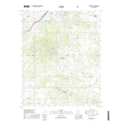
2018 Map of Williams South
USGS Topo · Published 2018About this map
Williams and its neighboring gateway, Williams Junction, sit at the northern edge of this high-elevation landscape within the Kaibab National Forest. The map documents a complex network of transportation and water management essential to this arid upland region. Modern infrastructure like the Bnsf Railway and I-40 Overpass RD. intersects with deep historical layers, including the Overland Road Historic Trail and the Old Rte 66 alignment. Dominating the central terrain is the massive Bill Williams Mtn, surrounded by named peaks like Bixler Mtn and Summit Mtn. The reliance on local hydrology is evident through numerous livestock tanks and larger catchments such as the Dogtown Reservoir and Upper Saginaw Reservoir. Notable local landmarks include Mountain View Cem and the distinctive geological formations of the McCracken Knolls and Hell Canyon.
Find a feature on this map
107 named features on this map. Tap any name to fly to it.
Don’t see what you’re looking for? This feature index may not catch every label — zoom into the map to look around manually.
Map Details
Editions of this 2018 Williams South Map
This is the sole edition of this map. No revisions or reprints were ever made.
Other maps of this area

1886 · Chino
USGS Topo · 1:250,000

1891 · Chino
USGS Topo · 1:250,000

1922 · Williams
USGS Topo · 1:125,000

1947 · Ash Fork
USGS Topo · 1:62,500

1948 · Ash Fork
USGS Topo · 1:63,360

1948 · Williams
USGS Topo · 1:250,000

1949 · Ash Fork
USGS Topo · 1:62,500

1954 · Williams
USGS Topo · 1:250,000

1956 · Williams
USGS Topo · 1:250,000

1960 · Williams
USGS Topo · 1:250,000