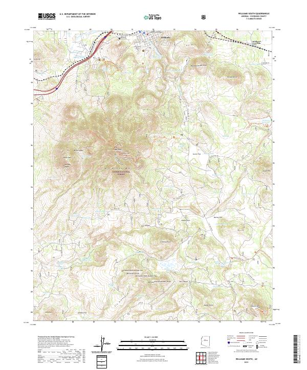
2021 Map of Williams South
USGS Topo · Published 2021About this map
Bill Williams Mtn dominates the central landscape of this portion of the Kaibab National Forest, rising above a complex network of canyons and high-elevation flats. The northern edge captures the transition from the mountain slopes to the urban fringe of Williams, including the Mountain View Cem and the industrial activity at Williams Junction. A significant cultural layer is preserved in the Overland Road Historic Trl, which winds through the southern terrain toward Summit Mtn, tracing a path once vital to early regional transit. The map is heavily marked by water management infrastructure essential for high-country life, from the Upper Saginaw Reservoir and Dogtown Reservoir to numerous named tanks like Wounded Ranger Tank and Bowdon Tank. These features, alongside named peaks such as Bixler Mtn and the distinct volcanic geography of the McCracken Knolls, document the intersection of forest service management and early Arizona settlement patterns.
Find a feature on this map
99 named features on this map. Tap any name to fly to it.
Don’t see what you’re looking for? This feature index may not catch every label — zoom into the map to look around manually.
Map Details
Editions of this 2021 Williams South Map
This is the sole edition of this map. No revisions or reprints were ever made.
Other maps of this area

1886 · Chino
USGS Topo · 1:250,000

1891 · Chino
USGS Topo · 1:250,000

1922 · Williams
USGS Topo · 1:125,000

1947 · Ash Fork
USGS Topo · 1:62,500

1948 · Ash Fork
USGS Topo · 1:63,360

1948 · Williams
USGS Topo · 1:250,000

1949 · Ash Fork
USGS Topo · 1:62,500

1954 · Williams
USGS Topo · 1:250,000

1956 · Williams
USGS Topo · 1:250,000

1960 · Williams
USGS Topo · 1:250,000