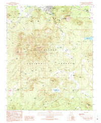
1989 Map of Williams South
USGS Topo · Published 1990About this map
Williams serves as the focal point of this late 20th-century survey, situated at the base of the massive Bill Williams Mountain. The area is a critical junction for the northern Arizona highland infrastructure, featuring the Williams Junction and the sprawling Kaibab National Forest. Water management is central to the landscape, evidenced by the Saginaw Reservoirs, City Reservoir, and the Dogtown Reservoir to the east. The map captures the town's transition into a recreation and service hub, noting the Williams Ski Area and Cataract Lake Campgrounds. Local genealogists and historians will find value in the precise location of the Mountain View Cemetery and the outlying Benham Ranch, while the numerous cattle tanks like Babbitt Tank and Wounded Ranger Tank illustrate the region's enduring ranching heritage.
Find a feature on this map
71 named features on this map. Tap any name to fly to it.
Don’t see what you’re looking for? This feature index may not catch every label — zoom into the map to look around manually.
Map Details
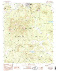
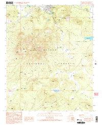
Editions of this 1989 Williams South Map
Other maps of this area

1886 · Chino
USGS Topo · 1:250,000

1891 · Chino
USGS Topo · 1:250,000

1922 · Williams
USGS Topo · 1:125,000

1947 · Ash Fork
USGS Topo · 1:62,500

1948 · Ash Fork
USGS Topo · 1:63,360

1948 · Williams
USGS Topo · 1:250,000

1949 · Ash Fork
USGS Topo · 1:62,500

1954 · Williams
USGS Topo · 1:250,000

1956 · Williams
USGS Topo · 1:250,000

1960 · Williams
USGS Topo · 1:250,000