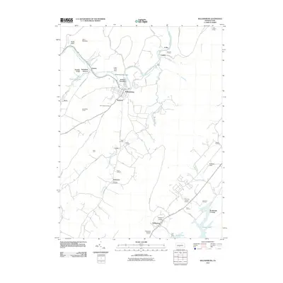
2010 Map of Williamsburg
USGS Topo · Published 2010About this map
The Frankstown Branch Juniata River carves through the heart of this landscape, defining the layout of historic industrial and residential nodes from Ganister down to Williamsburg. This 2010 survey details the complex geography of Blair County, where the river's path is marked by features like the Williamsburg Station Dam and the distinctively named Ganister Blue Hole. Family history and local heritage are deeply rooted in the numerous burial grounds scattered across the terrain, including Saint Josephs Cemetery, Biddle Cemetery, and the Old Stone Church Cemetery near Marklesburg. To the east, the terrain rises toward Redstone Ridge and the Loop Lookout Tower, while the southern reaches feature the Hitch Boat Launch and the Salmon Hole along the winding waterways. Small settlements and crossroads such as Covedale, Larke, and Shellytown provide a look at the persistent rural pattern of the region.
Find a feature on this map
60 named features on this map. Tap any name to fly to it.
Don’t see what you’re looking for? This feature index may not catch every label — zoom into the map to look around manually.
Map Details
Editions of this 2010 Williamsburg Map
This is the sole edition of this map. No revisions or reprints were ever made.
Other maps of this area

1901 · Huntingdon
USGS Topo · 1:62,500

1902 · Hollidaysburg
USGS Topo · 1:62,500

1903 · Hollidaysburg
USGS Topo · 1:62,500

1904 · Huntingdon
USGS Topo · 1:62,500

1920 · Altoona
USGS Topo · 1:62,500

1922 · Altoona
USGS Topo · 1:62,500

1923 · Tyrone
USGS Topo · 1:62,500

1929 · Tyrone
USGS Topo · 1:48,000

1933 · Tyrone
USGS Topo · 1:62,500

1946 · Tyrone
USGS Topo · 1:62,500
Featured Places
- Frankstown Township, PA
- Williamsburg, PA
- Marklesburg, PA
- Franklin Forge, Woodbury Township
- Lincoln Township, PA