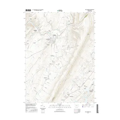
2016 Map of Williamsburg
USGS Topo · Published 2016About this map
The Frankstown Branch Juniata River carves a path through this section of the Ridge-and-Valley Appalachians, defining the local geography between Lock Mtn and the prominent Tussey Mountain. The settlement of Williamsburg serves as a central hub, surrounded by smaller communities such as Ganister, Robeson Extension, and Shelltown. This landscape is particularly rich for genealogical research, containing over a dozen burial sites including the Old Stone Church Cem, Bowers Family Cem, and Snively Cem. A unique geological landmark, the Arch Spring Natural Bridge, stands as a notable feature along Clover Cr. The map also reveals the area's infrastructure and recreational spots, from the Cove Valley Airport and Williamsburg Reservoir to the northern reaches of Raystown Lake near Marklesburg.
Find a feature on this map
67 named features on this map. Tap any name to fly to it.
Don’t see what you’re looking for? This feature index may not catch every label — zoom into the map to look around manually.
Map Details
Editions of this 2016 Williamsburg Map
This is the sole edition of this map. No revisions or reprints were ever made.
Other maps of this area

1901 · Huntingdon
USGS Topo · 1:62,500

1902 · Hollidaysburg
USGS Topo · 1:62,500

1903 · Hollidaysburg
USGS Topo · 1:62,500

1904 · Huntingdon
USGS Topo · 1:62,500

1920 · Altoona
USGS Topo · 1:62,500

1922 · Altoona
USGS Topo · 1:62,500

1923 · Tyrone
USGS Topo · 1:62,500

1929 · Tyrone
USGS Topo · 1:48,000

1933 · Tyrone
USGS Topo · 1:62,500

1946 · Tyrone
USGS Topo · 1:62,500
Featured Places
- Frankstown Township, PA
- Williamsburg, PA
- Marklesburg, PA
- Franklin Forge, Woodbury Township
- Lincoln Township, PA