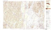
1990 Map of Williamsburg
USGS Topo · Published 1990About this map
The Connecticut River serves as the central artery for this late-twentieth-century landscape, carving a wide valley between the uplands of Conway State Forest and the dramatic heights of Mt Toby. The transition from the rural village of Williamsburg to the academic grounds of the University of Massachusetts in Amherst is clearly visible, reflecting the region's evolution from agrarian roots to a center of education and industry. Notable local landmarks like Smith Academy and the Williamsburg Station along the B & M RR corridor anchor the smaller settlements of Haydenville and Whately.
Find a feature on this map
105 named features on this map. Tap any name to fly to it.
Don’t see what you’re looking for? This feature index may not catch every label — zoom into the map to look around manually.
Map Details
Editions of this 1990 Williamsburg Map
2 editions found
Other maps of this area

1885 · Northampton
USGS Topo · 1:62,500

1886 · Hawley
USGS Topo · 1:62,500

1886 · Chesterfield
USGS Topo · 1:62,500

1886 · Northampton
USGS Topo · 1:62,500

1887 · Warwick
USGS Topo · 1:62,500

1887 · Belchertown
USGS Topo · 1:62,500

1888 · Chesterfield
USGS Topo · 1:62,500

1889 · Warwick
USGS Topo · 1:62,500

1890 · Hawley
USGS Topo · 1:62,500

1890 · Belchertown
USGS Topo · 1:62,500