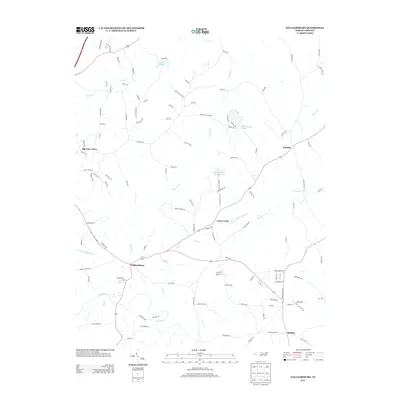
2013 Map of Williamsburg
USGS Topo · Published 2013About this map
Williamsburg and the surrounding rural communities of Lenox Castle and Ashland characterize this North Carolina landscape in the early twenty-first century. The area is defined by its intricate drainage network, where the Haw River flows across the southern portion of the sheet, joined by smaller tributaries like Rose Cr and Giles Cr. These waterways are complemented by man-made reservoirs, including the prominently featured Rockingham Lake and Williamsburg Wildlife Lake.
Find a feature on this map
124 named features on this map. Tap any name to fly to it.
Don’t see what you’re looking for? This feature index may not catch every label — zoom into the map to look around manually.
Map Details
Editions of this 2013 Williamsburg Map
This is the sole edition of this map. No revisions or reprints were ever made.
Other maps of this area

1951 · Browns Summit
USGS Topo · 1:24,000

1953 · Greensboro
USGS Topo · 1:250,000

1954 · Greensboro
USGS Topo · 1:250,000

1962 · Greensboro
USGS Topo · 1:250,000

1966 · Greensboro
USGS Topo · 1:250,000

1969 · Lake Burlington
USGS Topo · 1:24,000

1970 · Ossipee
USGS Topo · 1:24,000
1971 · Southeast Eden
USGS Topo · 1:24,000
1971 · Ruffin
USGS Topo · 1:24,000
1972 · Williamsburg
USGS Topo · 1:24,000