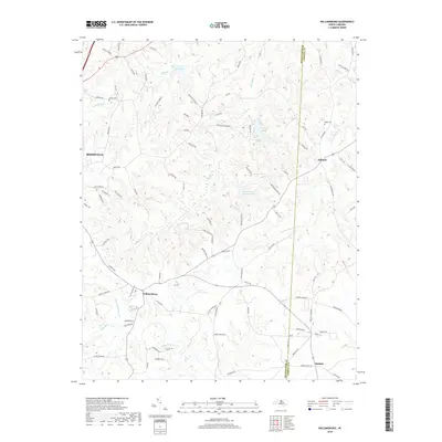
2019 Map of Williamsburg
USGS Topo · Published 2019About this map
The Haw River and its northern tributaries define the rural character of this border region between Rockingham and Caswell counties. The landscape is marked by small settlements such as Williamsburg and Ashland, connected by a network of farm roads like Manley Farm Rd and Green Meadow Rd. Significant water bodies including Lake Wade and the Williamsburg Wildlife Lake punctuate the rolling terrain, which is drained by Hogans Cr and Country Line Cr.
Find a feature on this map
95 named features on this map. Tap any name to fly to it.
Don’t see what you’re looking for? This feature index may not catch every label — zoom into the map to look around manually.
Map Details
Editions of this 2019 Williamsburg Map
This is the sole edition of this map. No revisions or reprints were ever made.
Other maps of this area

1951 · Browns Summit
USGS Topo · 1:24,000

1953 · Greensboro
USGS Topo · 1:250,000

1954 · Greensboro
USGS Topo · 1:250,000

1962 · Greensboro
USGS Topo · 1:250,000

1966 · Greensboro
USGS Topo · 1:250,000

1969 · Lake Burlington
USGS Topo · 1:24,000

1970 · Ossipee
USGS Topo · 1:24,000
1971 · Southeast Eden
USGS Topo · 1:24,000
1971 · Ruffin
USGS Topo · 1:24,000
1972 · Williamsburg
USGS Topo · 1:24,000