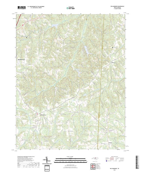
2022 Map of Williamsburg
USGS Topo · Published 2022About this map
Williamsburg and Ashland anchor the rural landscape of northern North Carolina near the Rockingham and Caswell County line. This modern topographic survey shows a region defined by its dense drainage networks, where the headwaters of the Haw River and Country Line Creek carve through the terrain. The presence of the Settle Cem and Apple Cem provides specific points of interest for genealogists tracing families in this part of the state. Small community hubs like Matkins are connected by a web of local routes such as Faucette Rd and Rockingham Lake Rd.
Find a feature on this map
96 named features on this map. Tap any name to fly to it.
Don’t see what you’re looking for? This feature index may not catch every label — zoom into the map to look around manually.
Map Details
Editions of this 2022 Williamsburg Map
This is the sole edition of this map. No revisions or reprints were ever made.
Other maps of this area

1951 · Browns Summit
USGS Topo · 1:24,000

1953 · Greensboro
USGS Topo · 1:250,000

1954 · Greensboro
USGS Topo · 1:250,000

1962 · Greensboro
USGS Topo · 1:250,000

1966 · Greensboro
USGS Topo · 1:250,000

1969 · Lake Burlington
USGS Topo · 1:24,000

1970 · Ossipee
USGS Topo · 1:24,000
1971 · Southeast Eden
USGS Topo · 1:24,000
1971 · Ruffin
USGS Topo · 1:24,000
1972 · Williamsburg
USGS Topo · 1:24,000