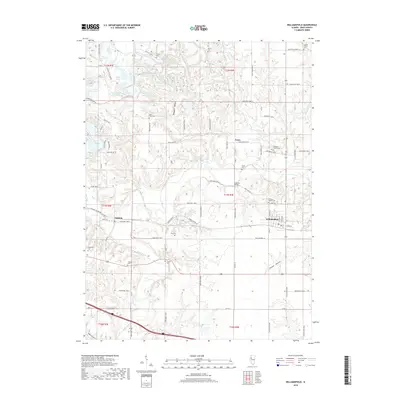
2018 Map of Williamsfield
USGS Topo · Published 2018About this map
The Spoon River cuts a winding course through this section of Knox County, defining the agricultural and social landscape around Williamsfield and Dahinda. This survey provides an detailed view of the rural cemetery network essential for genealogical research, including the West Truro Cem, Etherly Cem, and several private plots such as the Caldwell Family Cem and Williams Family Cem. The northern portion of the map is punctuated by an extensive system of small water bodies like Spoon Lake, Long Lake, and Chain-of Lakes, which contrast with the deeper, wooded drainages of Shakeden Hollow and Tucker Hollow. Local transportation is anchored by the crossing of the Spoon River at Lapham Bridge, while the small settlement of Truro serves as a historic point of reference amidst a grid of named county roads.
Find a feature on this map
90 named features on this map. Tap any name to fly to it.
Don’t see what you’re looking for? This feature index may not catch every label — zoom into the map to look around manually.
Map Details
Editions of this 2018 Williamsfield Map
This is the sole edition of this map. No revisions or reprints were ever made.
Other maps of this area

1931 · Galva
USGS Topo · 1:48,000

1940 · Galva
USGS Topo · 1:62,500

1941 · Maquon
USGS Topo · 1:62,500

1943 · Maquon
USGS Topo · 1:62,500

1944 · Galva
USGS Topo · 1:62,500

1944 · Kewanee
USGS Topo · 1:62,500

1944 · Elmwood
USGS Topo · 1:62,500

1948 · Elmwood
USGS Topo · 1:62,500

1958 · Burlington
USGS Topo · 1:250,000

1958 · Davenport
USGS Topo · 1:250,000