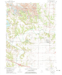
1982 Map of Williamsfield
USGS Topo · Published 1983About this map
The Atchison Topeka and Santa Fe railroad bisects the Illinois landscape here, connecting the settlements of Dahinda and Williamsfield along a route that follows the northern bank of the Spoon River. This early 1980s survey reveals a region defined by industrial transformation, where extensive Strip Mines dominate the northern townships of Copley and Victoria. These mining operations created a unique water-filled landscape, including a cluster of named bodies like Little John Club Lake, Green Oaks Lake, and Crawdad Lake.
Find a feature on this map
53 named features on this map. Tap any name to fly to it.
Don’t see what you’re looking for? This feature index may not catch every label — zoom into the map to look around manually.
Map Details
Editions of this 1982 Williamsfield Map
This is the sole edition of this map. No revisions or reprints were ever made.
Other maps of this area

1931 · Galva
USGS Topo · 1:48,000

1940 · Galva
USGS Topo · 1:62,500

1941 · Maquon
USGS Topo · 1:62,500

1943 · Maquon
USGS Topo · 1:62,500

1944 · Galva
USGS Topo · 1:62,500

1944 · Kewanee
USGS Topo · 1:62,500

1944 · Elmwood
USGS Topo · 1:62,500

1948 · Elmwood
USGS Topo · 1:62,500

1958 · Burlington
USGS Topo · 1:250,000

1958 · Davenport
USGS Topo · 1:250,000