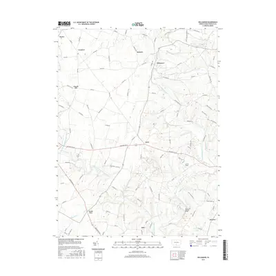
2016 Map of Williamson
USGS Topo · Published 2016About this map
Conococheague Creek and its many tributaries, including Back Creek and Paddy Run, dominate this Franklin County landscape. The area is defined by a dense network of country roads connecting small, established settlements like Williamson, Upton, and Welsh Run. A significant local landmark, the Martins Mill Covered Bridge, spans the creek in the southern portion of the quadrangle, reflecting the region's preservation of its structural heritage. The landscape reveals a mix of agricultural valley floor and residential pockets, with aviation interests represented by the JJ & PK Airport. Smaller hamlets such as Lemasters and Church Hill are situated along historic corridors like Steele Ave and Church Hill Rd, illustrating the persistent settlement patterns of rural Pennsylvania.
Find a feature on this map
98 named features on this map. Tap any name to fly to it.
Don’t see what you’re looking for? This feature index may not catch every label — zoom into the map to look around manually.
Map Details
Editions of this 2016 Williamson Map
This is the sole edition of this map. No revisions or reprints were ever made.
Other maps of this area

1900 · Mercersburg
USGS Topo · 1:62,500

1902 · Chambersburg
USGS Topo · 1:62,500

1902 · Mercersburg
USGS Topo · 1:62,500

1909 · Hagerstown
USGS Topo · 1:48,000

1912 · Hagerstown
USGS Topo · 1:62,500

1912 · Williamsport
USGS Topo · 1:62,500

1942 · Hagerstown
USGS Topo · 1:125,000

1943 · Hagerstown
USGS Topo · 1:125,000

1943 · Mercersburg
USGS Topo · 1:24,000

1943 · Chambersburg
USGS Topo · 1:62,500
Featured Places
- Antrim Township, PA
- Hamilton Township, PA
- Peters Township, PA
- Johnston, Antrim Township
- Bino, Montgomery Township