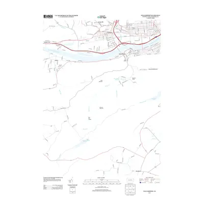
2013 Map of Williamsport
USGS Topo · Published 2013About this map
The West Br Susquehanna River serves as the central artery for this Lycoming County landscape, separating the dense grid of Newberry and the industrial corridors of Williamsport from the southern settlements of Duboistown and Nisbet. The map reveals a sharp transition from the urban developments along Wahoo Dr and Reach Rd to the steep, wooded slopes of Jacks Mountain and Raccoon Mountain. This geography is defined by a system of narrow valleys and hollows, such as Fox Hollow and Bear Pen Hollow, which historically channeled local development and water management. Significant infrastructure for the region's water supply is evident in the Mosquito Valley Reservoir and Mosquito Run Reservoir. The southern portion of the sheet remains largely rural, where the remote French Settlement and the village of Elimsport anchor a landscape of winding runs and mountain trails.
Find a feature on this map
88 named features on this map. Tap any name to fly to it.
Don’t see what you’re looking for? This feature index may not catch every label — zoom into the map to look around manually.
Map Details
Editions of this 2013 Williamsport Map
This is the sole edition of this map. No revisions or reprints were ever made.
Other maps of this area

1921 · Williamsport
USGS Topo · 1:48,000

1921 · Trout Run
USGS Topo · 1:62,500

1923 · Trout Run
USGS Topo · 1:62,500

1923 · Williamsport
USGS Topo · 1:62,500

1924 · Milton
USGS Topo · 1:62,500

1930 · Warrensville
USGS Topo · 1:62,500

1934 · Warrensville
USGS Topo · 1:62,500

1944 · Trout Run
USGS Topo · 1:62,500

1944 · Williamsport
USGS Topo · 1:62,500

1953 · Warrensville
USGS Topo · 1:62,500
Featured Places
- Williamsport, PA
- Garden View, Old Lycoming Township
- Duboistown, PA
- Bastress Township, PA
- Woodward Township, PA