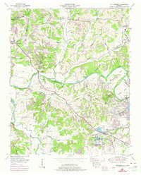
1951 Map of Williamsport
USGS Topo · Published 1974About this map
Duck River snakes across this mid-century landscape, carving a deep valley defined by dramatic bluffs like Dorsett Bluff and Bratton Bluff. The settlement of Williamsport sits at a strategic bend in the river, serving as a focal point for the surrounding rural communities of Arkland, Sawdust, and Chartersville. The presence of the Natchez Trace and the Louisville and Nashville Railroad Company indicates a long history of transit through this portion of Maury County.
Find a feature on this map
78 named features on this map. Tap any name to fly to it.
Don’t see what you’re looking for? This feature index may not catch every label — zoom into the map to look around manually.
Map Details
Editions of this 1951 Williamsport Map
3 editions found
Other maps of this area

1901 · Colombia
USGS Topo · 1:125,000

1936 · Godwin
USGS Topo · 1:24,000

1936 · Williamsport
USGS Topo · 1:24,000

1936 · Primm
USGS Topo · 1:24,000

1936 · Mt Joy
USGS Topo · 1:24,000

1936 · Littlelot
USGS Topo · 1:24,000

1936 · Theta
USGS Topo · 1:24,000

1936 · Greenfield Bend
USGS Topo · 1:24,000

1936 · Mount Pleasant
USGS Topo · 1:24,000

1936 · Columbia
USGS Topo · 1:24,000