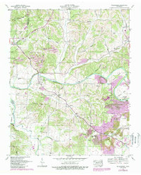
1951 Map of Williamsport
USGS Topo · Published 1989About this map
The Duck River meanders through this portion of Maury County, defining a landscape where rural crossroads like Williamsport and Santa Fe serve as focal points for the surrounding agricultural and mining operations. This 1951 survey, with later revisions, shows the significant footprint of the extraction industry, particularly north of the river near Griffin Hill and south along Bank Ridge, where numerous Strip Mines and Tailings Ponds are documented. These industrial features sit in close proximity to long-established family homesteads and landmarks like McKennon Cem and Bryant Cem.
Find a feature on this map
75 named features on this map. Tap any name to fly to it.
Don’t see what you’re looking for? This feature index may not catch every label — zoom into the map to look around manually.
Map Details
Editions of this 1951 Williamsport Map
3 editions found
Other maps of this area

1901 · Colombia
USGS Topo · 1:125,000

1936 · Godwin
USGS Topo · 1:24,000

1936 · Williamsport
USGS Topo · 1:24,000

1936 · Primm
USGS Topo · 1:24,000

1936 · Mt Joy
USGS Topo · 1:24,000

1936 · Littlelot
USGS Topo · 1:24,000

1936 · Theta
USGS Topo · 1:24,000

1936 · Greenfield Bend
USGS Topo · 1:24,000

1936 · Mount Pleasant
USGS Topo · 1:24,000

1936 · Columbia
USGS Topo · 1:24,000