2023 Map of Williamsport
USGS Topo · Published 2023About this map
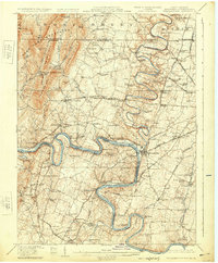
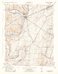
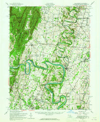
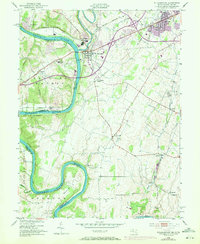
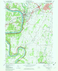
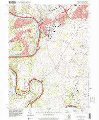
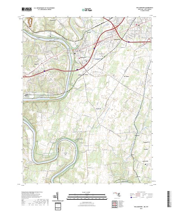
Williamsport and its riverine surroundings are defined by the winding course of the Potomac River, where the historic Chesapeake and Ohio Canal follows the Maryland shore. The map illustrates a landscape shaped by early transportation and agricultural development, featuring numerous small hamlets such as Downsville, Spielman, and Bakersville. The intricate hydrology of the area is highlighted by Conococheague Creek joining the Potomac and the presence of landforms like The Horse Shoe and Whitings Neck. Local genealogy is well-represented through several historic burial grounds, including Saint Augustines Graveyard, Bnai Abraham Cem, and River View Cem. Residual evidence of the river's historical role as a crossing point appears in labels for Lemons Ferry and Lights Ferry, while the modern industrial corridor is marked by CSX Transportation tracks and the suburban expansion of Halfway.
Find a feature on this map
110 named features on this map. Tap any name to fly to it.
Don’t see what you’re looking for? This feature index may not catch every label — zoom into the map to look around manually.
Map Details
Editions of this 2023 Williamsport Map
This is the sole edition of this map. No revisions or reprints were ever made.
Historical Maps of Fairplay Farms Through Time
7 maps found