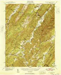
1949 Map of Williamsville
USGS Topo · Published 1949About this map
The Cowpasture River and its numerous tributaries, including Bullpasture River and Stuart Run, carve through the complex ridge systems of the George Washington National Forest. This late 1940s survey captures a landscape of small rural settlements and religious centers such as Williamsville, Burnsville, and Fort Lewis. The distribution of rural landmarks like Stony Run Ch, Starr Chapel, and the Flood Sch indicates a community-centered mountain economy that relied on the valleys between Jack Mountain and Warm Springs Mountain.
Find a feature on this map
113 named features on this map. Tap any name to fly to it.
Don’t see what you’re looking for? This feature index may not catch every label — zoom into the map to look around manually.
Map Details
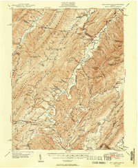
Editions of this 1949 Williamsville Map
2 editions found
Other maps of this area

1894 · Staunton
USGS Topo · 1:125,000

1894 · Natural Bridge
USGS Topo · 1:125,000

1894 · Lexington
USGS Topo · 1:125,000

1901 · Monterey
USGS Topo · 1:125,000

1922 · Cass
USGS Topo · 1:48,000

1923 · Warm Springs
USGS Topo · 1:48,000

1924 · Cass
USGS Topo · 1:62,500

1924 · Mc Dowell
USGS Topo · 1:62,500

1926 · Warm Springs
USGS Topo · 1:62,500

1930 · Warm Springs Run
USGS Topo · 1:24,000