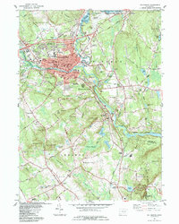
1984 Map of Willimantic
USGS Topo · Published 1984About this map
Willimantic stands as a significant urban and industrial hub at the confluence of the Natchaug River and Shetucket River in the mid-1980s. The dense street grid is anchored by institutions like Eastern Conn State College and Windham High Sch, while the industrial legacy is visible in the rail lines of the Central Vermont and Providence and Worcester railroads. The map captures the transition from the city's concentrated core to the outlying agricultural and rural areas of Windham, Lebanon, and Franklin.
Find a feature on this map
95 named features on this map. Tap any name to fly to it.
Don’t see what you’re looking for? This feature index may not catch every label — zoom into the map to look around manually.
Map Details
Editions of this 1984 Willimantic Map
This is the sole edition of this map. No revisions or reprints were ever made.
Other maps of this area

1892 · Woodstock
USGS Topo · 1:62,500

1892 · Tolland
USGS Topo · 1:62,500

1892 · Norwich
USGS Topo · 1:62,500

1892 · Gilead
USGS Topo · 1:62,500

1921 · Tolland
USGS Topo · 1:62,500

1921 · Woodstock
USGS Topo · 1:62,500

1943 · Fitchville
USGS Topo · 1:31,680

1944 · South Coventry
USGS Topo · 1:31,680
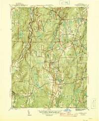
1944 · Hampton
USGS Topo · 1:31,680

1944 · Columbia
USGS Topo · 1:31,680