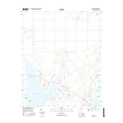
2016 Map of Williston
USGS Topo · Published 2016About this map
Otway, Bettie, and Smyrna form a cluster of coastal settlements along the intricate shoreline of the Atlantic Ocean in this coastal survey. The geography is defined by a dense network of tidal inlets and creeks, including Gillikin Creek, Wade Creek, and Middens Creek, which separate the mainland from productive wetlands like Thomas Marsh. The coastal economy is evidenced by the positioning of roads such as Harkers Island Rd and Old River Rd that navigate the narrow necks of land between the North River and Jarrett Bay.
Find a feature on this map
57 named features on this map. Tap any name to fly to it.
Don’t see what you’re looking for? This feature index may not catch every label — zoom into the map to look around manually.
Map Details
Editions of this 2016 Williston Map
This is the sole edition of this map. No revisions or reprints were ever made.
Other maps of this area

1949 · Beaufort
USGS Topo · 1:24,000

1949 · Long Bay
USGS Topo · 1:24,000

1949 · Merrimon
USGS Topo · 1:24,000

1949 · Williston
USGS Topo · 1:24,000

1949 · Harkers Island
USGS Topo · 1:24,000

1949 · South River
USGS Topo · 1:24,000

1949 · Davis
USGS Topo · 1:24,000

1949 · Core Creek
USGS Topo · 1:24,000

1950 · Horsepen Point
USGS Topo · 1:24,000

1950 · Long Bay
USGS Topo · 1:24,000