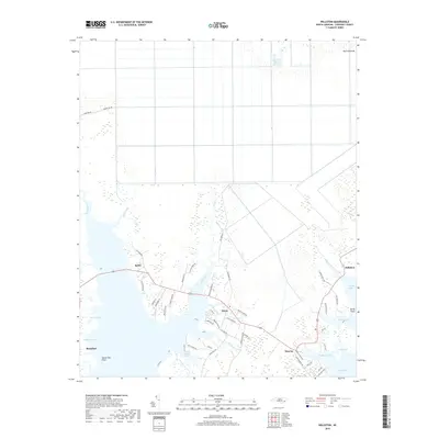
2019 Map of Williston
USGS Topo · Published 2019About this map
The coastal hamlets of Williston, Smyrna, and Otway anchor this survey of the North Carolina tidewater, where the land fragmentizes into the vast Core Sound and Jarrett Bay. The landscape is defined by its maritime geography, with intricate waterways like North River, Ward Creek, and Williston Creek carving into the low-lying terrain. To the north, the expanse of Open Grounds contrasts with the dense network of marshlands and points including Thomas Marsh, Sandy Point, and Marsh Hen Point. Local roads such as Panther Rd and Harkers Island Rd connect these waterfront communities, reflecting a settlement pattern deeply tied to the sounds and estuaries. This map captures the transition from mainland Carteret County to the amphibious environment of the outer coast, highlighting the small settlements and named creeks that have shaped the region's coastal identity for generations.
Find a feature on this map
57 named features on this map. Tap any name to fly to it.
Don’t see what you’re looking for? This feature index may not catch every label — zoom into the map to look around manually.
Map Details
Editions of this 2019 Williston Map
This is the sole edition of this map. No revisions or reprints were ever made.
Other maps of this area

1949 · Beaufort
USGS Topo · 1:24,000

1949 · Long Bay
USGS Topo · 1:24,000

1949 · Merrimon
USGS Topo · 1:24,000

1949 · Williston
USGS Topo · 1:24,000

1949 · Harkers Island
USGS Topo · 1:24,000

1949 · South River
USGS Topo · 1:24,000

1949 · Davis
USGS Topo · 1:24,000

1949 · Core Creek
USGS Topo · 1:24,000

1950 · Horsepen Point
USGS Topo · 1:24,000

1950 · Long Bay
USGS Topo · 1:24,000