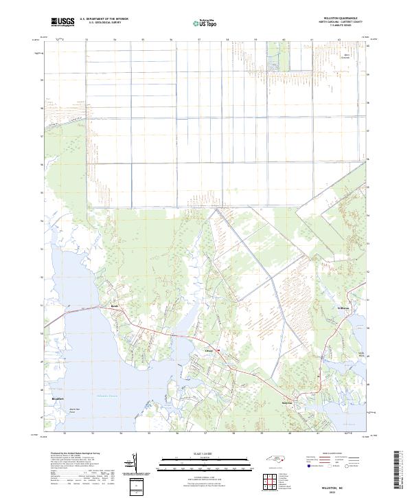
2022 Map of Williston
USGS Topo · Published 2022About this map
Coastal hamlets and intricate salt marshes define the landscape of eastern Carteret County, where the southern boundary meets the Atlantic Ocean and Core Sound. This survey captures the network of small fishing and boat-building communities such as Smyrna, Williston, and Otway as they appeared in the early 2020s. The northern portion of the quadrangle is dominated by the vast Open Grounds area, while the southern reaches are fragmented by tidal waters like Jarrett Bay and Leopard Cr. Local genealogical value is found in the many family-named roads and landmarks, including Amos Gillikin Rd and Donnie Davis Rd. The map illustrates how US Route 70 serves as the primary artery connecting these maritime settlements, bridging the gaps between North River and the complex drainage of Ward Cr and Gillikin Cr.
Find a feature on this map
56 named features on this map. Tap any name to fly to it.
Don’t see what you’re looking for? This feature index may not catch every label — zoom into the map to look around manually.
Map Details
Editions of this 2022 Williston Map
This is the sole edition of this map. No revisions or reprints were ever made.
Other maps of this area

1949 · Beaufort
USGS Topo · 1:24,000

1949 · Long Bay
USGS Topo · 1:24,000

1949 · Merrimon
USGS Topo · 1:24,000

1949 · Williston
USGS Topo · 1:24,000

1949 · Harkers Island
USGS Topo · 1:24,000

1949 · South River
USGS Topo · 1:24,000

1949 · Davis
USGS Topo · 1:24,000

1949 · Core Creek
USGS Topo · 1:24,000

1950 · Horsepen Point
USGS Topo · 1:24,000

1950 · Long Bay
USGS Topo · 1:24,000