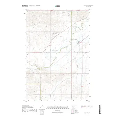
2020 Map of Willow Creek
USGS Topo · Published 2020About this map
The Jefferson River winds through a broad valley where Gallatin, Broadwater, Jefferson, and Madison counties meet, defining a landscape shaped by water and early western transit. The small community of Willow Creek serves as a central hub, surrounded by a high density of burial grounds including Willow Creek Cem, Mount Green Cem, and Stateler Cem, providing significant touchpoints for genealogical research. Irrigation infrastructure, such as the Highland Ditch and Buzaleman Ditch, underscores the importance of water management for local agriculture in this semi-arid region. Historical transportation routes are prominent, most notably the Old Yellowstone Trl, which follows the river's path. Other landmarks like the Meridian Bridge and the Ottertail Lake Airport highlight the mix of traditional river crossings and modern utility that characterizes this portion of the Montana countryside.
Find a feature on this map
47 named features on this map. Tap any name to fly to it.
Don’t see what you’re looking for? This feature index may not catch every label — zoom into the map to look around manually.
Map Details
Editions of this 2020 Willow Creek Map
This is the sole edition of this map. No revisions or reprints were ever made.
Other maps of this area

1888 · Three Forks
USGS Topo · 1:250,000

1894 · Three Forks
USGS Topo · 1:250,000

1895 · Three Forks
USGS Topo · 1:250,000

1947 · Bozeman
USGS Topo · 1:250,000

1948 · Bozeman
USGS Topo · 1:250,000

1949 · Norris
USGS Topo · 1:62,500

1950 · Three Forks
USGS Topo · 1:62,500

1950 · Jefferson Island
USGS Topo · 1:62,500

1950 · Harrison
USGS Topo · 1:62,500

1951 · Norris
USGS Topo · 1:62,500