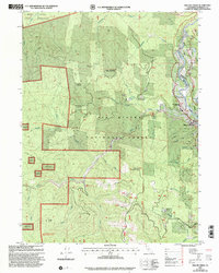
1997 Map of Willow Creek
USGS Topo · Published 2001About this map
The confluence of the Trinity River and Willow Creek anchors this late-1990s study of eastern Humboldt County. Within the Six Rivers National Forest, the landscape transitions from the protected timberlands of the Hoopa Valley Indian Reservation in the north to high-elevation landmarks like Lookout Brush Mountain and Indian Butte. The map details the local infrastructure of the Willow Creek settlement, documenting the Trinity Valley School, a riverside Golf Course, and the Willow Creek Airport.
Find a feature on this map
48 named features on this map. Tap any name to fly to it.
Don’t see what you’re looking for? This feature index may not catch every label — zoom into the map to look around manually.
Map Details
Editions of this 1997 Willow Creek Map
This is the sole edition of this map. No revisions or reprints were ever made.
Other maps of this area

1915 · Big Bar and Vicinity
USGS Topo · 1:250,000

1922 · Korbel
USGS Topo · 1:62,500

1922 · China Flat
USGS Topo · 1:62,500

1925 · Hoopa
USGS Topo · 1:125,000

1945 · Coyote Peak
USGS Topo · 1:62,500

1945 · Blue Lake
USGS Topo · 1:62,500

1948 · Weed
USGS Topo · 1:250,000

1950 · Weed
USGS Topo · 1:250,000

1951 · Blue Lake
USGS Topo · 1:62,500

1952 · Willow Creek
USGS Topo · 1:62,500