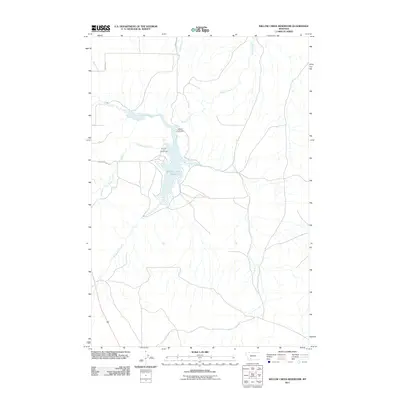
2011 Map of Willow Creek Reservoir
USGS Topo · Published 2011About this map
Willow Creek Reservoir dominates this Gallatin County landscape, serving as a central hub for drainage from the surrounding Montana uplands. Fed by Norwegian Creek from the south and Dry Hollow Creek from the west, the reservoir is contained by the Willow Creek Dam at its northern narrow. The presence of the Harrison Lake Campground along the western shore indicates the area's role as a recreational destination.
Find a feature on this map
11 named features on this map. Tap any name to fly to it.
Don’t see what you’re looking for? This feature index may not catch every label — zoom into the map to look around manually.
Map Details
Editions of this 2011 Willow Creek Reservoir Map
This is the sole edition of this map. No revisions or reprints were ever made.
Other maps of this area

1888 · Three Forks
USGS Topo · 1:250,000

1894 · Three Forks
USGS Topo · 1:250,000

1895 · Three Forks
USGS Topo · 1:250,000

1947 · Bozeman
USGS Topo · 1:250,000

1948 · Bozeman
USGS Topo · 1:250,000

1949 · Norris
USGS Topo · 1:62,500

1950 · Three Forks
USGS Topo · 1:62,500

1950 · Jefferson Island
USGS Topo · 1:62,500

1950 · Harrison
USGS Topo · 1:62,500

1951 · Norris
USGS Topo · 1:62,500