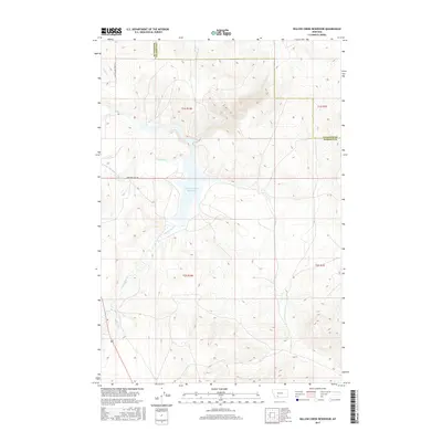
2017 Map of Willow Creek Reservoir
USGS Topo · Published 2017About this map
Willow Creek Reservoir dominates this landscape along the border of Madison and Gallatin counties. The area is defined by a network of drainage and irrigation, notably the Roebert and Warren Ditch which cuts across the western terrain near Harrison Lake Rd. These water management features represent the agricultural history and hydraulic engineering required to manage the semi-arid high country. Historical transportation routes are evident in the Old Yellowstone Trl, reflecting the early twentieth-century push for reliable motor paths through the American West. Fed by Willow Cr and Norwegian Cr, the reservoir serves as a central point for the surrounding cattle country and ranching land. Smaller seasonal watercourses like Dry Hollow Cr and Sand Cr carve through the draws and ridges, illustrating the natural watershed before it reaches the larger basin.
Find a feature on this map
15 named features on this map. Tap any name to fly to it.
Don’t see what you’re looking for? This feature index may not catch every label — zoom into the map to look around manually.
Map Details
Editions of this 2017 Willow Creek Reservoir Map
This is the sole edition of this map. No revisions or reprints were ever made.
Other maps of this area

1888 · Three Forks
USGS Topo · 1:250,000

1894 · Three Forks
USGS Topo · 1:250,000

1895 · Three Forks
USGS Topo · 1:250,000

1947 · Bozeman
USGS Topo · 1:250,000

1948 · Bozeman
USGS Topo · 1:250,000

1949 · Norris
USGS Topo · 1:62,500

1950 · Three Forks
USGS Topo · 1:62,500

1950 · Jefferson Island
USGS Topo · 1:62,500

1950 · Harrison
USGS Topo · 1:62,500

1951 · Norris
USGS Topo · 1:62,500