
1967 Map of Willow Creek SW
USGS Topo · Published 1970About this map
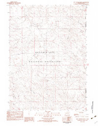
Cedar Bluffs dominates the topography of this South Dakota landscape, where the Missouri River Basin development program documented the complex drainage patterns of the late 1960s. The map illustrates a highly dissected terrain defined by the winding course of Cedar Bluff Creek and its associated breaks. This area, surveyed through photogrammetric methods, reveals a landscape shaped by intermittent water action, with the West Fork Willow Creek and Middle Fork Willow Creek carving deep into the plateau. The survey was conducted as part of a Department of the Interior initiative to map the hydrologic character of the region, providing a detailed view of the natural landmarks and relief that defined Shannon County before later administrative renamings.
Find a feature on this map
4 named features on this map. Tap any name to fly to it.
Don’t see what you’re looking for? This feature index may not catch every label — zoom into the map to look around manually.
Map Details
Editions of this 1967 Willow Creek SW Map
This is the sole edition of this map. No revisions or reprints were ever made.
Other maps of this area

1896 · Oelrichs
USGS Topo · 1:125,000

1900 · Oelrichs
USGS Topo · 1:125,000

1951 · Willow Creek NW
USGS Topo · 1:24,000

1951 · Willow Creek NE
USGS Topo · 1:24,000

1951 · Smithwick NE
USGS Topo · 1:24,000

1955 · Hot Springs
USGS Topo · 1:250,000

1967 · Slim Butte NW
USGS Topo · 1:24,000

1967 · Slim Butte NE
USGS Topo · 1:24,000

1967 · Willow Creek
USGS Topo · 1:24,000
1982 · Hay Canyon Butte
USGS Topo · 1:25,000