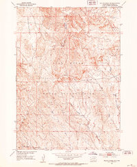
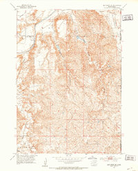
1951 Map of Willow Creek NW
USGS Topo · Published 1953About this map
Pine Ridge Indian Reservation lands dominate this mid-century topographic study, showcasing a landscape defined by dramatic drainage systems and high plateaus. The northern portion of the map is anchored by the prominent Squaw-Humper Table, a flat-topped landform that gives way to a complex network of eroded drainages including Squaw-Humper Creek.
Find a feature on this map
6 named features on this map. Tap any name to fly to it.
Don’t see what you’re looking for? This feature index may not catch every label — zoom into the map to look around manually.
Map Details
Editions of this 1951 Willow Creek NW Map
2 editions found

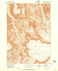
Other maps of this area

1894 · Hermosa
USGS Topo · 1:125,000

1896 · Oelrichs
USGS Topo · 1:125,000

1900 · Oelrichs
USGS Topo · 1:125,000

1901 · Hermosa
USGS Topo · 1:125,000
1951 · Fairburn SE
USGS Topo · 1:24,000
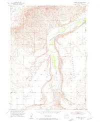
1951 · Willow Creek NE
USGS Topo · 1:24,000
1951 · Red Shirt SW
USGS Topo · 1:24,000
1951 · Smithwick NE
USGS Topo · 1:24,000
1951 · Cuny Table West
USGS Topo · 1:24,000

1955 · Hot Springs
USGS Topo · 1:250,000