
1951 Map of Red Shirt SW
USGS Topo · Published 1953About this map
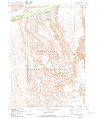
The Pine Ridge Indian Reservation landscape is defined by dramatic plateau formations and the winding course of the Cheyenne River. Mapped in the early 1950s as part of a development program for the Missouri River Basin, this area reveals the stark topography of the Squaw Humper Table and the Red Shirt Table. These high, flat-topped features are separated by intricate drainage systems, including Squaw-Humper Creek and Little Squaw-Humper Creek. The map also captures the administrative boundary between Custer and Shannon counties, which follows the river's path. This survey emphasizes the intersection of natural landforms and jurisdictional borders, providing a clear record of the reservation's northern geographic limits before later land-use changes altered the local infrastructure.
Find a feature on this map
10 named features on this map. Tap any name to fly to it.
Don’t see what you’re looking for? This feature index may not catch every label — zoom into the map to look around manually.
Map Details
Editions of this 1951 Red Shirt SW Map
2 editions found
Other maps of this area

1894 · Hermosa
USGS Topo · 1:125,000

1896 · Oelrichs
USGS Topo · 1:125,000

1900 · Oelrichs
USGS Topo · 1:125,000

1901 · Hermosa
USGS Topo · 1:125,000

1951 · Fairburn SE
USGS Topo · 1:24,000

1951 · Red Shirt
USGS Topo · 1:24,000

1951 · Willow Creek NW
USGS Topo · 1:24,000

1951 · Willow Creek NE
USGS Topo · 1:24,000

1951 · Red Shirt NE
USGS Topo · 1:24,000

1951 · Smithwick NE
USGS Topo · 1:24,000