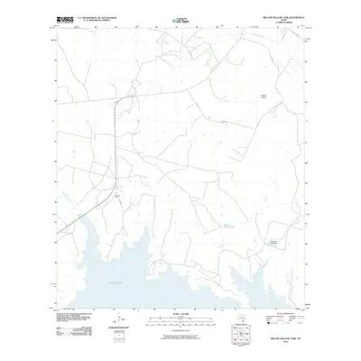
2010 Map of Willow Hollow Tank
USGS Topo · Published 2010About this map
Jacob Oil Field and a network of county roads define this portion of the Texas brush country, where energy extraction and ranching shape the rural landscape. The southern reaches of the map are dominated by the extensive waters of Yarbrough Lake, while the north is drained by the Atascosa River and its tributaries, including Olmos Creek and Opossum Creek. Local water management is evident through features like Willow Hollow Tank and the Raschke Lake Dam, essential infrastructure for livestock and land use in this arid region. The terrain is further marked by Ursher Hollow and the drainage of Comanche Branch. This 2010 survey illustrates the continued importance of fossil fuel production alongside traditional water-dependent land management in Atascosa County.
Find a feature on this map
14 named features on this map. Tap any name to fly to it.
Don’t see what you’re looking for? This feature index may not catch every label — zoom into the map to look around manually.
Map Details
Editions of this 2010 Willow Hollow Tank Map
This is the sole edition of this map. No revisions or reprints were ever made.
Other maps of this area

1920 · Mikeska
USGS Topo · 1:125,000

1925 · Simmons No. 1
USGS Topo · 1:48,000

1925 · Crowther No. 3
USGS Topo · 1:48,000

1925 · Simmons No. 2
USGS Topo · 1:48,000

1927 · Oakville
USGS Topo · 1:62,500

1929 · Simmons
USGS Topo · 1:62,500

1930 · Whitsett
USGS Topo · 1:62,500

1942 · Whitsett
USGS Topo · 1:62,500

1953 · Crystal City
USGS Topo · 1:250,000

1955 · Crystal City
USGS Topo · 1:250,000