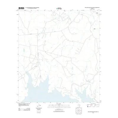
2012 Map of Willow Hollow Tank
USGS Topo · Published 2012About this map
Jacob Oil Field defines much of the industrial character in this pocket of Atascosa County, where the landscape is marked by the infrastructure of energy extraction. The northern reach of the map is shaped by the winding course of the Atascosa River, which is joined by local drainages including Olmos Cr and Opossum Cr. Water management is a primary feature of the terrain, visible through numerous catchments and reservoirs such as Willow Hollow Tank, Raschke Lake, and the larger Yarbrough Lake in the southern section. The road network, including Jambers Rd and FM 99, connects these remote industrial sites and ranchlands. To the northeast, the landform known as Ursher Hollow provides a distinct topographic break in an otherwise regulated landscape of oil fields and private roads.
Find a feature on this map
16 named features on this map. Tap any name to fly to it.
Don’t see what you’re looking for? This feature index may not catch every label — zoom into the map to look around manually.
Map Details
Editions of this 2012 Willow Hollow Tank Map
This is the sole edition of this map. No revisions or reprints were ever made.
Other maps of this area

1920 · Mikeska
USGS Topo · 1:125,000

1925 · Simmons No. 1
USGS Topo · 1:48,000

1925 · Crowther No. 3
USGS Topo · 1:48,000

1925 · Simmons No. 2
USGS Topo · 1:48,000

1927 · Oakville
USGS Topo · 1:62,500

1929 · Simmons
USGS Topo · 1:62,500

1930 · Whitsett
USGS Topo · 1:62,500

1942 · Whitsett
USGS Topo · 1:62,500

1953 · Crystal City
USGS Topo · 1:250,000

1955 · Crystal City
USGS Topo · 1:250,000