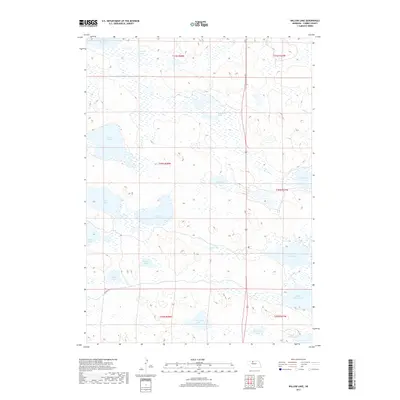
2017 Map of Willow Lake
USGS Topo · Published 2017About this map
Willow Lake and a dense network of water bodies dominate this portion of the Nebraska Sandhills in Cherry County. This 2017 survey illustrates a landscape defined by its hydrology, where large basins like Dewey Lake and Trout Lake sit alongside smaller, specialized features such as Billiards Marsh. The map provides a detailed view of the regional drainage patterns, showing the proximity of North Marsh Lake and South Marsh Lake in the eastern section of the quadrangle.
Find a feature on this map
23 named features on this map. Tap any name to fly to it.
Don’t see what you’re looking for? This feature index may not catch every label — zoom into the map to look around manually.
Map Details
Editions of this 2017 Willow Lake Map
This is the sole edition of this map. No revisions or reprints were ever made.
Other maps of this area

1949 · Long Lake
USGS Topo · 1:62,500

1950 · Simeon
USGS Topo · 1:62,500

1950 · Arabia
USGS Topo · 1:62,500

1951 · Long Lake
USGS Topo · 1:62,500

1951 · Brownlee
USGS Topo · 1:62,500

1957 · Valentine
USGS Topo · 1:250,000

1959 · Valentine
USGS Topo · 1:250,000

1985 · Long Lake
USGS Topo · 1:24,000
1985 · Arabia SW
USGS Topo · 1:24,000

1985 · Goose Creek
USGS Topo · 1:100,000