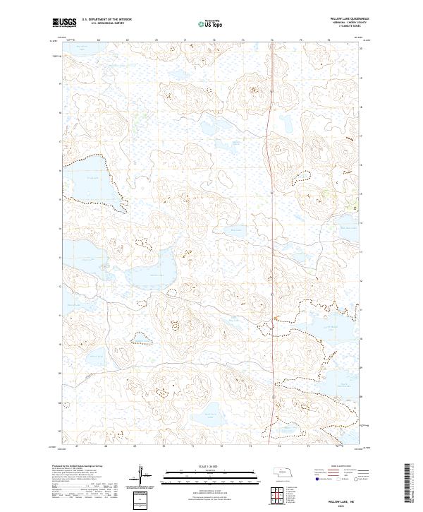
2021 Map of Willow Lake
USGS Topo · Published 2021About this map
The Nebraska Sandhills dominate this landscape in Cherry County, defined by a complex network of wetlands and shallow lakes. At the center of the sheet lies Willow Lake, part of a series of hydrologic features including Clear Lake and Trout Lake. The terrain is characterized by stabilized sand dunes and depressions that collect water, creating significant habitats like Ballards Marsh and North Marsh Lake.
Find a feature on this map
23 named features on this map. Tap any name to fly to it.
Don’t see what you’re looking for? This feature index may not catch every label — zoom into the map to look around manually.
Map Details
Editions of this 2021 Willow Lake Map
This is the sole edition of this map. No revisions or reprints were ever made.
Other maps of this area

1949 · Long Lake
USGS Topo · 1:62,500

1950 · Simeon
USGS Topo · 1:62,500

1950 · Arabia
USGS Topo · 1:62,500

1951 · Long Lake
USGS Topo · 1:62,500

1951 · Brownlee
USGS Topo · 1:62,500

1957 · Valentine
USGS Topo · 1:250,000

1959 · Valentine
USGS Topo · 1:250,000

1985 · Long Lake
USGS Topo · 1:24,000
1985 · Arabia SW
USGS Topo · 1:24,000

1985 · Goose Creek
USGS Topo · 1:100,000