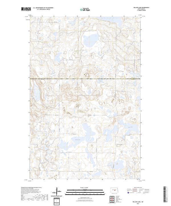
2024 Map of Willow Lake
USGS Topo · Published 2024About this map
Willow Lake and Swan Lake dominate a glacial prairie landscape defined by significant wetland conservation efforts in central North Dakota. This survey, compiled from data through 2022, details a transition zone between Wells Co and Kidder Co, where the environment is managed via the Wells County Waterfowl Production Area and the Kidder County Waterfowl Production Area. These protected zones provide critical habitats within the Prairie Pothole Region, reflecting the state's ongoing commitment to migratory bird conservation. The terrain is organized by a strict sectional grid, with gravel roads such as 33rd Ave SE and 9th St SE providing access to the remote lake basins and surrounding agricultural tracts. This 2024 edition offers a precise view of current hydrological boundaries and land use at the boundary of these two counties.
Find a feature on this map
24 named features on this map. Tap any name to fly to it.
Don’t see what you’re looking for? This feature index may not catch every label — zoom into the map to look around manually.
Map Details
Editions of this 2024 Willow Lake Map
This is the sole edition of this map. No revisions or reprints were ever made.
Other maps of this area

1951 · Bowdon
USGS Topo · 1:24,000

1952 · New Rockford
USGS Topo · 1:250,000

1956 · New Rockford
USGS Topo · 1:250,000

1971 · New Rockford
USGS Topo · 1:250,000

1972 · Tuttle
USGS Topo · 1:24,000

1972 · Robinson
USGS Topo · 1:24,000

1972 · Des Moines Lake
USGS Topo · 1:24,000

1978 · Wagon Wheel Hill
USGS Topo · 1:24,000
1978 · Willow Lake
USGS Topo · 1:24,000
1978 · Senior Lake
USGS Topo · 1:24,000