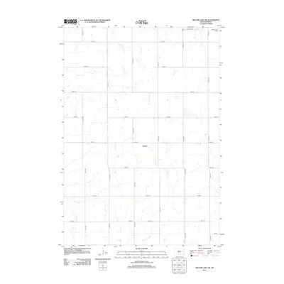
2012 Map of Willow Lake SW
USGS Topo · Published 2012About this map
Melham sits at the center of this agricultural landscape in Clark County, South Dakota. This 2012 survey documents the section lines and farmstead placements that define the prairie's grid-like organization. The terrain is characterized by numerous small basins and wetlands scattered across the plains, while Redstone Cr provides the primary drainage through the southwestern portion of the sheet. Transportation is rooted in a system of gravel avenues and streets, including Grant St and Co Hwy-47, which connect local residents to the broader region. Local history is anchored by the Collins Cem near the northern border, and the presence of the Willow Lake Airport in the northeast corner highlights the area's ongoing connection to regional general aviation.
Find a feature on this map
22 named features on this map. Tap any name to fly to it.
Don’t see what you’re looking for? This feature index may not catch every label — zoom into the map to look around manually.
Map Details
Editions of this 2012 Willow Lake SW Map
This is the sole edition of this map. No revisions or reprints were ever made.
Other maps of this area

1899 · De Smet
USGS Topo · 1:125,000

1953 · Watertown
USGS Topo · 1:250,000

1958 · Watertown
USGS Topo · 1:250,000

1971 · Bancroft East
USGS Topo · 1:24,000

1971 · De Smet
USGS Topo · 1:24,000

1971 · Bancroft West
USGS Topo · 1:24,000

1973 · Carpenter SE
USGS Topo · 1:24,000

1973 · Willow Lake
USGS Topo · 1:24,000

1973 · Vienna West
USGS Topo · 1:24,000
1973 · Cherry Lake
USGS Topo · 1:24,000