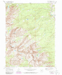
1970 Map of Willow Lakes
USGS Topo · Published 1988About this map
The Gore Range forms a formidable spine across this high-altitude survey, serving as the boundary between the Arapaho National Forest and White River National Forest. At the time of this photogrammetric survey, the landscape was largely defined by the protected wilderness of the Eagles Nest Wilderness and a complex hydrological network feeding into the Blue River. Traces of earlier extractive industry remain at the Boss Mine and various unnamed prospects scattered along the slopes of Keller Mountain.
Find a feature on this map
40 named features on this map. Tap any name to fly to it.
Don’t see what you’re looking for? This feature index may not catch every label — zoom into the map to look around manually.
Map Details
Editions of this 1970 Willow Lakes Map
4 editions found
Other maps of this area

1929 · Dillon
USGS Topo · 1:62,500

1933 · Mt. Powell
USGS Topo · 1:48,000

1933 · Ute Peak
USGS Topo · 1:62,500

1934 · Minturn
USGS Topo · 1:62,500

1934 · Dillon
USGS Topo · 1:62,500

1937 · Ute Peak
USGS Topo · 1:62,500

1940 · Mount Powell
USGS Topo · 1:62,500

1950 · Minturn
USGS Topo · 1:62,500

1957 · Leadville
USGS Topo · 1:250,000

1959 · Leadville
USGS Topo · 1:250,000