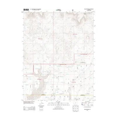
2013 Map of Willow Spring
USGS Topo · Published 2013About this map
San Juan National Forest lands dominate the southern half of this quadrangle, defining a landscape utilized for water management and resource protection. This 2013 survey reveals an intricate network of highland hydrology, where numerous man-made catchments like Andrews Reservoir, Carlyle Reservoir, and the series of numbered reservoirs including Middle Number 5 Reservoir and Little Beaver Number 3 Reservoir gather water from the drainages of Plateau Cr and Summer Camp Cr.
Find a feature on this map
54 named features on this map. Tap any name to fly to it.
Don’t see what you’re looking for? This feature index may not catch every label — zoom into the map to look around manually.
Map Details
Editions of this 2013 Willow Spring Map
This is the sole edition of this map. No revisions or reprints were ever made.
Other maps of this area

1956 · Cortez
USGS Topo · 1:250,000

1958 · Cortez
USGS Topo · 1:250,000

1959 · Cortez
USGS Topo · 1:250,000

1962 · Cortez
USGS Topo · 1:250,000

1963 · Stoner
USGS Topo · 1:24,000
1963 · Nipple Mountain
USGS Topo · 1:24,000
1964 · Groundhog Reservoir
USGS Topo · 1:24,000

1964 · Glade Mountain
USGS Topo · 1:24,000
1964 · South Mountain
USGS Topo · 1:24,000

1965 · Willow Spring
USGS Topo · 1:24,000