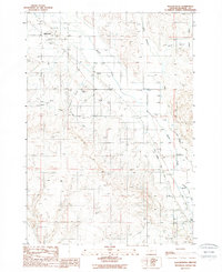
1988 Map of Willowcreek
USGS Topo · Published 1988About this map
The historical route of the Oregon Trail and the Vale Oregon Trail cross this high desert landscape, marking the enduring legacy of westward migration through eastern Oregon. Concentrated around the small settlements of Willowcreek and Dennis, the map illustrates a complex irrigation infrastructure essential for local agriculture in the late 1980s. A network including the Main Canal, Warm Springs Pump Canal, and a Concrete Diversion Dam on Willow Creek manages the flow of water across the arid terrain. Beyond the irrigated fields, the landscape is defined by rugged features such as Alkali Flats, Dry Gulch, and Haymaker Gulch. Infrastructure like various Siphons and a Gravel Pit reflect the mid-century development of Malheur County, where the desert was adapted for modern use while preserving the paths of pioneer travelers.
Find a feature on this map
18 named features on this map. Tap any name to fly to it.
Don’t see what you’re looking for? This feature index may not catch every label — zoom into the map to look around manually.
Map Details
Editions of this 1988 Willowcreek Map
This is the sole edition of this map. No revisions or reprints were ever made.
Other maps of this area

1906 · Mitchell Butte
USGS Topo · 1:125,000

1950 · Jamieson
USGS Topo · 1:62,500

1951 · Moores Hollow
USGS Topo · 1:62,500

1955 · Baker
USGS Topo · 1:250,000

1955 · Boise
USGS Topo · 1:250,000

1958 · Boise
USGS Topo · 1:250,000

1959 · Baker
USGS Topo · 1:250,000

1962 · Boise
USGS Topo · 1:250,000
1967 · Vale East
USGS Topo · 1:24,000
1967 · Vines Hill
USGS Topo · 1:24,000