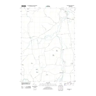
2010 Map of Willsboro
USGS Topo · Published 2010About this map
The Boquet River meanders through the heart of this Essex County landscape, defining the corridor between the Adirondacks and Lake Champlain. The settlement of Willsboro serves as a primary hub, while smaller hamlets like Reber, Boquet, and Whallonsburg anchor the surrounding rural valleys. The area is characterized by a series of prominent peaks, including Sugarloaf Mountain, North Boquet Mountain, and South Boquet Mountain, which create a complex system of drainage for waterways such as Cold Brook and Spruce Mill Brook.
Find a feature on this map
57 named features on this map. Tap any name to fly to it.
Don’t see what you’re looking for? This feature index may not catch every label — zoom into the map to look around manually.
Map Details
Editions of this 2010 Willsboro Map
This is the sole edition of this map. No revisions or reprints were ever made.
Other maps of this area

1894 · Elizabethtown
USGS Topo · 1:62,500

1894 · Port Henry
USGS Topo · 1:62,500

1895 · Willsboro
USGS Topo · 1:62,500

1895 · Elizabethtown
USGS Topo · 1:62,500

1895 · Ausable
USGS Topo · 1:62,500

1898 · Port Henry
USGS Topo · 1:62,500

1901 · Elizabethtown
USGS Topo · 1:62,500

1903 · Ausable
USGS Topo · 1:62,500

1941 · Willsboro
USGS Topo · 1:62,500

1943 · Willsboro
USGS Topo · 1:62,500