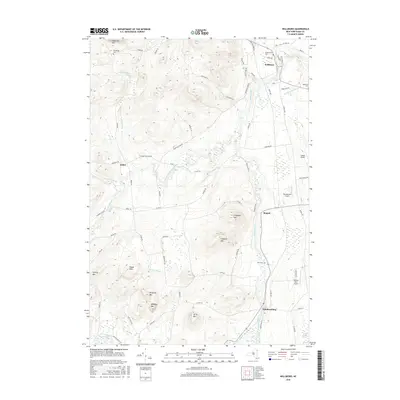
2016 Map of Willsboro
USGS Topo · Published 2016About this map
The Boquet River meanders through this portion of Essex County, anchoring a landscape where small aviation strips and historic hamlets coexist. The settlement of Willsboro sits in the northern reaches, near the confluence of Brandywine Brook and the main river channel. Local genealogy is well-preserved through numerous burial sites, including Boardman Cem in the northwest and Burt Cem further south. The terrain is defined by a series of prominent peaks such as Sugarloaf Mtn, Payne Mtn, and the dual summits of N Boquet Mtn and S Boquet Mtn. Aviation enthusiasts will note a cluster of private airfields, including Sunset Airport and the uniquely named Bonebender Airport. In the south, the village of Whallonsburg lies near the edge of the Webb Royce Swamp, illustrating the transition from the high peaks to the low-lying wetlands of the Champlain Valley.
Find a feature on this map
76 named features on this map. Tap any name to fly to it.
Don’t see what you’re looking for? This feature index may not catch every label — zoom into the map to look around manually.
Map Details
Editions of this 2016 Willsboro Map
This is the sole edition of this map. No revisions or reprints were ever made.
Other maps of this area

1894 · Elizabethtown
USGS Topo · 1:62,500

1894 · Port Henry
USGS Topo · 1:62,500

1895 · Willsboro
USGS Topo · 1:62,500

1895 · Elizabethtown
USGS Topo · 1:62,500

1895 · Ausable
USGS Topo · 1:62,500

1898 · Port Henry
USGS Topo · 1:62,500

1901 · Elizabethtown
USGS Topo · 1:62,500

1903 · Ausable
USGS Topo · 1:62,500

1941 · Willsboro
USGS Topo · 1:62,500

1943 · Willsboro
USGS Topo · 1:62,500