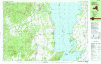
1980 Map of Willsboro
USGS Topo · Published 1980About this map
Lake Champlain dominates the eastern half of this survey, where the New York and Vermont border runs through the deep waters of Whallon Bay and Town Farm Bay. Along the New York shore, the Delaware and Hudson railroad tracks parallel the coast, connecting the riverside settlement of Willsboro with Whallonsburg and the landing at Essex Station. The landscape reflects a mix of early industry and established local life, with several Mines located near Bristol Mtn and various Sandpits scattered across the inland hills.
Find a feature on this map
89 named features on this map. Tap any name to fly to it.
Don’t see what you’re looking for? This feature index may not catch every label — zoom into the map to look around manually.
Map Details
Editions of this 1980 Willsboro Map
This is the sole edition of this map. No revisions or reprints were ever made.
Other maps of this area

1894 · Elizabethtown
USGS Topo · 1:62,500

1894 · Port Henry
USGS Topo · 1:62,500

1895 · Willsboro
USGS Topo · 1:62,500

1895 · Elizabethtown
USGS Topo · 1:62,500

1895 · Ausable
USGS Topo · 1:62,500

1898 · Port Henry
USGS Topo · 1:62,500

1901 · Elizabethtown
USGS Topo · 1:62,500

1903 · Ausable
USGS Topo · 1:62,500

1903 · Middlebury
USGS Topo · 1:62,500

1905 · Middlebury
USGS Topo · 1:62,500