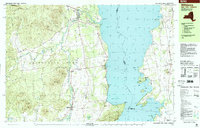
1999 Map of Willsboro
USGS Topo · Published 2000About this map
The Bouquet River winds through the eastern edge of the Adirondack Park before reaching Lake Champlain in this late-century landscape. The topography transitions from the interior heights of Sugarloaf Mtn and Bristol Mtn down to the historic lakefront settlements of Essex and Willsboro. Along the river valley, the village of Whallonsburg and the nearby Whallon Bay Cem reflect the long-standing agricultural and maritime character of the region.
Find a feature on this map
75 named features on this map. Tap any name to fly to it.
Don’t see what you’re looking for? This feature index may not catch every label — zoom into the map to look around manually.
Map Details
Editions of this 1999 Willsboro Map
This is the sole edition of this map. No revisions or reprints were ever made.
Other maps of this area

1894 · Elizabethtown
USGS Topo · 1:62,500

1894 · Port Henry
USGS Topo · 1:62,500

1895 · Willsboro
USGS Topo · 1:62,500

1895 · Elizabethtown
USGS Topo · 1:62,500

1895 · Ausable
USGS Topo · 1:62,500

1898 · Port Henry
USGS Topo · 1:62,500

1901 · Elizabethtown
USGS Topo · 1:62,500

1903 · Ausable
USGS Topo · 1:62,500

1903 · Middlebury
USGS Topo · 1:62,500

1905 · Middlebury
USGS Topo · 1:62,500