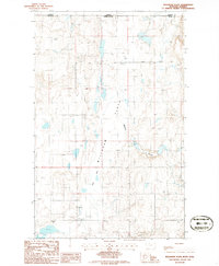
1986 Map of Willshaw Flats
USGS Topo · Published 1986About this map
Willshaw Flats characterizes this stretch of the northern frontier, where the high plains of Montana meet the Alberta border. The 1986 survey documents a landscape of ephemeral water and geological depressions, most notably the expansive Lake Bed and Alkali Flat. Human presence is marked by the utilities required for survival in an arid environment, including a Well Covered Reservoir and scattered wells. In the southeast, the terrain drops toward the drainage of Beaupre Coulee. This map serves as a detailed record of the international boundary during the mid-1980s, tracing the line between Toole County and Warner County and the border separating the United States and Canada. Local industry and genealogy are represented by a roadside Gravel Pit and a lone Cem, providing specific points of interest for researchers tracing land use and burial sites in this remote borderland.
Find a feature on this map
12 named features on this map. Tap any name to fly to it.
Don’t see what you’re looking for? This feature index may not catch every label — zoom into the map to look around manually.
Map Details
Editions of this 1986 Willshaw Flats Map
This is the sole edition of this map. No revisions or reprints were ever made.
Other maps of this area

1939 · Sunburst
USGS Topo · 1:62,500

1945 · West Butte
USGS Topo · 1:62,500

1954 · Shelby
USGS Topo · 1:250,000

1958 · Shelby
USGS Topo · 1:250,000

1984 · Sweet Grass Hills
USGS Topo · 1:100,000
1986 · Ferdig
USGS Topo · 1:24,000
1986 · Sunburst
USGS Topo · 1:24,000
1986 · Beaupre Coulee
USGS Topo · 1:24,000
1986 · Kevin North
USGS Topo · 1:24,000
1986 · Fivemile Coulee West
USGS Topo · 1:24,000