
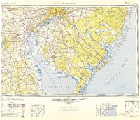
1946 Map of Wilmington
USGS Topo · Published 1948About this map
Industrial centers and coastal defenses define the Mid-Atlantic corridor just after the war, anchored by the dense urban blocks of Philadelphia, Wilmington, and Camden. The navigation of the Delaware River is vital to the region's economy, supported by the critical Chesapeake and Delaware Canal and a network of maritime safeguards including the Ship John Shoal Light and Miah Maull Shoal Lighthouse.
Find a feature on this map
240 named features on this map. Tap any name to fly to it.
Don’t see what you’re looking for? This feature index may not catch every label — zoom into the map to look around manually.
Map Details
Editions of this 1946 Wilmington Map
2 editions found
Other maps of this area

1884 · Sea Isle
USGS Topo · 1:62,500

1884 · Whitings
USGS Topo · 1:62,500

1887 · Atlantic City
USGS Topo · 1:62,500

1888 · Bordentown
USGS Topo · 1:62,500

1888 · Pemberton
USGS Topo · 1:62,500

1888 · Barnegat
USGS Topo · 1:62,500

1888 · Cape May
USGS Topo · 1:62,500

1888 · Dennisville
USGS Topo · 1:62,500

1888 · Little Egg Harbor
USGS Topo · 1:62,500

1888 · Mount Holly
USGS Topo · 1:62,500