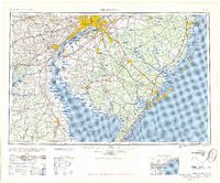
1957 Map of Wilmington
USGS Topo · Published 1957About this map
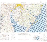
Philadelphia and the burgeoning industrial corridor of the Delaware River anchor this mid-century survey, which reveals a region rapidly modernizing through massive infrastructure projects. The newly established New Jersey Turnpike and Garden State Parkway are clearly visible, reshaping the movement of people and goods between the major hubs of Camden and Wilmington. Along the coastline, the Atlantic Ocean meets a series of barrier islands and inlets, including the prominent resort city of Atlantic City and the growing developments at Ocean City. The map captures the specialized transport landscape of the era, where traditional rail systems like the Pennsylvania-Reading Seashore Lines operate alongside critical maritime channels such as the Chesapeake and Delaware Canal. From the Fort Dix Military Reservation in the north to the lighthouses of Delaware Bay, this study documents a pivotal moment of suburban and industrial expansion.
Find a feature on this map
114 named features on this map. Tap any name to fly to it.
Don’t see what you’re looking for? This feature index may not catch every label — zoom into the map to look around manually.
Map Details
Editions of this 1957 Wilmington Map
2 editions found
Other maps of this area

1884 · Sea Isle
USGS Topo · 1:62,500

1884 · Whitings
USGS Topo · 1:62,500

1887 · Atlantic City
USGS Topo · 1:62,500

1888 · Bordentown
USGS Topo · 1:62,500

1888 · Pemberton
USGS Topo · 1:62,500

1888 · Barnegat
USGS Topo · 1:62,500

1888 · Cape May
USGS Topo · 1:62,500

1888 · Dennisville
USGS Topo · 1:62,500

1888 · Little Egg Harbor
USGS Topo · 1:62,500

1888 · Mount Holly
USGS Topo · 1:62,500