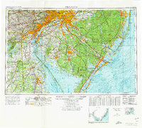
1972 Map of Wilmington
USGS Topo · Published 1976About this map
The Delaware River corridor and the expansive Pine Barrens dominate this mid-1970s topographic-bathymetric survey, capturing the industrial density of Philadelphia and Wilmington set against the protected wilderness of southern New Jersey. This era shows the heavy transportation infrastructure connecting the Tri-State area, including the New Jersey Turnpike and the Penn Central railroad lines. Along the coast, the map details the intricate waterways of Barnegat Bay and the developed shorelines of Atlantic City and Ocean City, providing a precise look at the bathymetry and shoreline changes just before the modern era of coastal management.
Find a feature on this map
76 named features on this map. Tap any name to fly to it.
Don’t see what you’re looking for? This feature index may not catch every label — zoom into the map to look around manually.
Map Details
Editions of this 1972 Wilmington Map
2 editions found
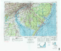
Other maps of this area

1884 · Sea Isle
USGS Topo · 1:62,500

1884 · Whitings
USGS Topo · 1:62,500

1887 · Atlantic City
USGS Topo · 1:62,500

1888 · Bordentown
USGS Topo · 1:62,500

1888 · Pemberton
USGS Topo · 1:62,500

1888 · Barnegat
USGS Topo · 1:62,500

1888 · Cape May
USGS Topo · 1:62,500

1888 · Dennisville
USGS Topo · 1:62,500

1888 · Little Egg Harbor
USGS Topo · 1:62,500

1888 · Mount Holly
USGS Topo · 1:62,500